Gil (GoHiker.com) and I hiked the High Sierra Trail to Mt. Whitney, June 17-22. Here is Day 4 of our hike:
| If you’ve hiked the High Sierra Trail or plan to do so in the future, please join our Facebook Group, High Sierra Trail! |
The Plan
- Day 4 (Sat) – Kern Hot Springs to Wallace Creek Crossing (36.590791,-118.370433)
- Kern Hot Springs to Junction Meadow (36.577869,-118.414035)
- 7.5 miles || +1275, -70
- Junction Meadow to Wallace Creek
- 4.7 miles || +2340, -10
- LEG 4 Total: 12.2 miles || +3615, -80 || 8 hrs
- Kern Hot Springs to Junction Meadow (36.577869,-118.414035)
The Outcome
I was up early again to make sure I did some stretching before we got started. The air was quite cool and I actually hiked a few miles while wearing my long sleeve merino base layer. The first part of our day closely followed the Kern River, alternating between areas of heavy tree cover and no trees at all. The slight incline of the trail was actually a nice change from all of the downhill we hiked the day before. I made frequent stops to take some long(er) exposure photos of the water and the snow plants.
 |
 |
 |
 |
Since leaving camp, we had discussed the possibility of taking the Whitney Creek shortcut. Day 3 was a long day and the idea of shortening our trip by 10-12 miles was appealing. Fewer miles meant fewer steps, which would hopefully mean less time and pounding on our feet. I kept looking to the east as we hiked, wondering where exactly this shortcut was and how difficult it would be. As we neared Whitney Creek, there seemed to be a few use trails headed to the east, so we wondered if others had been using the shortcut.
After a long lunch break and loading up with water, we put on our heavy packs and headed off trail. For much of the cross-country section, we could see tracks left by another hiker, which closely followed the GPX file that I had downloaded prior to our hike. The bottom section wasn’t bad – it was not very steep and the biggest obstacle was finding our way around the brush. After a few minutes, the terrain got very steep.
Oddly, I enjoyed the steep terrain. It was a nice change from all of the downhill that we had done the day before and reminded me of some of the terrain I covered this past winter with snowshoes and crampons. It was quite easy to follow the other hiker’s tracks, so we focused on our footing, stopping in the shade where available for frequent breaks and making sure we were well hydrated.
As we reached the end of our steep climb, we lost the tracks and could not find them. Our GPS units were also useless because the signals were bouncing off the steep canyon walls that surrounded us. At this point, I realized that I should have printed out a detailed topographical map of this section, with the GPX track overlayed onto it. I compared the GPX file, the printed map that I did have and the terrain that was in front of us. Nothing matched up as well as I hoped, so we decided that we needed to pick a line and make our way to the top. After walking around for a few minutes and weighing different options, we picked a route and went for it. It started off ok, but after a few minutes, we got into an area that made both of us uncomfortable. Backtracking did not seem like a viable option, so I helped Gil get up over a section that didn’t offer many hand or footholds. After putting down his pack and confirming that there wasn’t a better route for me, he lowered some paracord to pull my pack up. We then used the paracord as a safety line in the event of a slip and to give me an extra boost if needed.
After a few tense moments, we took a long break and took in the scenery while we rested. The hardest part of our day was over, but we still had a couple of miles of cross country travel before reaching the packer camp. The climb had taken much longer than anticipated and we were both very tired.
 |
 |
 |
 |
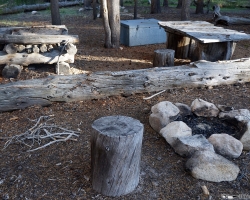
Thankfully the rest of our day was uneventful. We found the packer camp without much problem, quickly setup camp, ate dinner and went to bed. I realized that each successive day on this hike had been harder than the last and that I had just gone through 3 of my most physically and mentally challenging days; I prayed the trend would reverse soon.
 |
 |
 |
Video Courtesy of GoHiker.com
The shorcut saved us some mileage on day 4, but our time on the trail was much longer than expected.
Leg 4 (as tracked): Kern Hot Springs to Packer Camp || 8 miles || +3563, -470 || +3093 net elevation gain || 13 hours
Water & Food
The morning was quite cool and I didn’t drink much before we prepped for the Whitney Creek Shortcut. At lunch time, I drank 1.5 liters, then loaded up with 4 liters before starting our climb. By the time we reached top of the eastern side of Kern Trench (just over a mile, but nearly 2000 ft of elevation gain), I was out of water.
- Before starting our hike for the day, I tried to eat more of the macadamias – I can’t even stand to look at them anymore!
- Triscuits and Jack Link’s Beef Sticks we awesome again, as were the Hi-Chews I ate after running out of water.
- I had Mountain House Potatoes with bacon jerky for dinner – not enough to replace the calories burned, but I had no appetite.
Gear
A few notes on the gear I used.
- WoolX Merino Wool
- Merino wool ¼ Zip Baselayer Top
- Once again, I started and ended my day wearing this top. I thought about leaving it at home and just bringing my puffy for insulation, but this top have very nice to hike in. My puffy is too hot for hiking.
- Merino wool ¼ Zip Baselayer Top
- Farm to Feet Merino Wool Socks
- High Points
- The don’t stink, but will need to be washed soon due to all of the dirt I picked up on the shortcut.
- High Points
- Delorme InReach, provided by LowerGear.com’s Rental Service
- Delorme was useful for navigated the shortcut until signal starting bouncing off of the canyon walls.
- Nalgene Cantene
- I tore a large hole in the cantene on some brush. I will need to repair it.
- Mountainsmith Boundary 75L Backpack
- The pack felt great today.
Http iframes are not shown in https pages in many major browsers. Please read this post for details.
The gallery below (25 photos) loads slowly. Thank you for your patience.