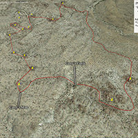
Using GPSVisualizer Draw to create a simple GPX file
I have tried several websites and methods for creating tracks for hikes that I am unable to locate gpx files for. What I’ve found is that most methods add waypoint, routepoint or linepoint data to the files. My GPS unit (Garmin Dakota 20) fails to load a track file if it contains anything other than trackpoint data. Thus far, GPSVisualizer Draw is the easiest way to create a gpx file that only contains latitude and longitude information.
- Visit the GPS Visualizer Freehand Drawing Utility website (http://www.gpsvisualizer.com/draw/)
- Select the map you want to use by clicking on the arrow in the upper right hand corner of the screen.
- Navigate to the area where you want to create the gpx file by dragging the map and/or zooming in. You can also use the search box in the upper-left hand corner.
- On the right, under ‘Drawing Tools,’ click on trk
- Draw your track by clicking on the map.
- When you’ve finished drawing the track, click on the gpx button, which is located near the trk button
- A link to your gpx file will appear below the gpx button. Right-click on the link and save the file to your computer.
- This file can be loaded onto your GPS unit.
Adding (geek) stats to simple GPX files
I like to have a printed map and a GPX file for all of my hikes if possible, especially if it involves some off trail or x-country sections. I have been making my own printed maps for a while, by either scanning the large maps I have or taking screen shots of the trails. I then import these images into software (Gimp, Photoshop, Fireworks) to add stats and highlight my route.
Since I have started hiking routes that are off trail or obscure, I am finding it increasingly difficult to find the information I need to create the (geek) stats I like to have for my hikes. The process I have come up with takes some work and if you don’t need this information, it is unnecessary. If you just want to create a simple GPX file that can be viewed on your GPS unit, GPSVisualizer Draw is the easiest option (see above). Before we get to the process I use, here are some examples of what I created from the information harvested in this process:
- Map out the route using the steps above
- Save the GPX file. Save it with the suffix STEP1 (ie MyHike_STEP1.gpx)
- Upload your GPX file to GPSVisualizer to add elevation information*. Export as a KML file.
- Go to: http://www.gpsvisualizer.com/map_input?form=googleearth
- Next to ‘Add DEM elevation data:’ select the source you want to use
- Customize your file using the available options. The only thing I do is ‘Colorize by’ to ‘Track’
- In the right hand column, click ‘Choose File’ and select the file created in step 1 .
- Click ‘Create KML File’
- Right-click on the KML file, and save the KML file to your computer with the suffix STEP2 *this step is optional, but I like to have elevation information included in my files
- Open the KML file in Garmin Basecamp. Export a .gpx for you GPS unit
- File > Import into, then select the file you created in Step 2.
- In the bottom left pane, you may see a list of waypoints/routepoints for the file you imported. They will have a flag icon next to them or something similar. I usually delete these.
- Scroll down past the way/route points (if you haven’t deleted them), until you see the track. The title should be something like ‘Gmap4_Route##’ or ‘Hiking 4/29/14’. Right-click on the file and select ‘Rename.’ Rename it to something descriptive (ie Mt. Baldy via Register Ridge)
- In the Library pane (upper left), you should see the name of the file you imported. Click on it once to highlight it. The go to File > Export > Export Selection.By default, ‘.gpx’ should be the file type. Save the file with the suffix ‘STEP3.’ This is the file for your GPS unit.
- Upload the file to your GPS unit and test it.
- Create a new folder in the Library Pane
- Right-click on the ‘My Collection’ folder. Select ‘New list folder’
- Name it something descriptive (ie Cottonwood Pass Trip, May 2014)
- Drag and drop the section of your hike into this folder
- Click on the folder name once to highlight it. Then go to File > Export > Export ‘your folder name here’.
- Change the ‘Save as type;’ selection box to ‘KML’
- Click ‘Save’
You can now double-click on that file to open it in Google Earth
Once in Google Earth, you can view the elevation profiles of route(s), add information in the description of each route or even harvest information for your printable map. Here is an example of what can be done using a combination of Google Earth and Gmap4: Cottonwood Pass Trip, May 2014


Gilbert Mendoza
Great post, dude.
TheHikingGeek
Thanks!
I am curious if other GPS unts are as finicky about GPX files as Garmins. Do you know anyone that uses non-Garmin GPS devices?