

| If you regularly hike or backpack in California, please join our Facebook group, California Hiking and Backpacking! It’s a great place to ask questions and share your photos, trip reports and gear recommendations. |
Having received some new gear over the last couple of weeks, I was very eager to get out on the trail to find some snow. I recently learned about a challenging cross-country route to the summit of Alto Diablo Peak (10,563’) and after finding a recent trip report for this route, I knew it would present a good opportunity for me to use my winter gear.
The Plan
Due to my hectic schedule, I had only slept 12 hours total in the 72 hours leading up to this hike. Since I knew that I would be exhausted, I planned for two routes leaving from the South Fork Trailhead. The preferred hike was to summit Alto Diablo Peak using a cross-country route. I’ve seen this route called several names including: Duct Tape Ridge, Devil’s Ridge and The NE Ridge Route. My backup plan was to follow South Fork Trail to Poopout Hill, then follow Poopout Trail until it crossed South Fork Trail. From that point I’d follow an old road back to the trailhead, creating a figure-8 shape. Based on my research:
- I estimated the Alto Diablo Peak Route (red) was 8 miles roundtrip and should take me 8 hours.
- The Poopout Hill Figure 8 (blue) mapped out to around 6 miles should take less than 3 hrs.
 |
 |
I planned to be on the trail by 5:00 am. Multiple forecasts showed that I should be prepared for temperatures ranging from 38-60 degrees.
The Outcome
I had to drag myself out of bed and I didn’t start hiking until about 6:00 am. The temperature was 41 degrees and it was only a few minutes before I was peeling off layers. It took me 75 minutes to cover the first 2.1 miles, which was longer than I had expected. The lack of sleep over the previous 3 days and lack of exercise over the past 3 weeks seemed to be taking their toll. I wanted to opt for the easier hike, but since the snow cover was minimal at that elevation (~8k ft), I decided I should take the cross-country route to Alto Diablo.
It didn’t take long before my pace really slowed down; with sparse snow cover the route was not always obvious and I was frequently checking my GPS to make sure I was headed in the right direction. Due to the conditions, there were multiple footwear changes that also contributed to my slow pace:
- 0.0 > 2.1 miles – no winter traction needed
- 2.1 > 3.5 miles – K•10 Hiking Crampons (review coming soon)
- 3.5 > 6.4 miles – MSR Denali Classic Snowshoes (from the 3.5 mile mark up to the peak and partially down the mountain)
- 6.4 > 7.3 miles – K•10 Hiking Crampons
- 7.3 > 9.4 miles – no winter traction needed
With the switch to snowshoes around 9400 feet, my pace slowed further and I felt like I was on the verge of cramps for the remainder of the ascent. Less than 1/8 mile from the summit, my left quad locked up on me and I had to stop for a few minutes. I took it easy the rest of the way to the summit. The ascent took about 5 hours total. I took a 30 minute break for food and photos and was back at the trailhead 8 hours and 15 minutes after I had started the hike.
Geek Stats
- Notes:
- The first 1.3 miles of cross country route has an average slope of >30%
- Timing breakdown
- 5 hr ascent || 30 min break || 2 hr 45 min descent
- 5 hr ascent || 30 min break || 2 hr 45 min descent
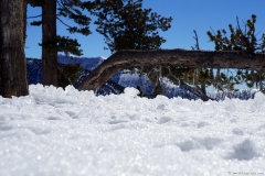
The photo gallery below will load slowly. Thank you for your patience.


Gear
Being a winter hike, my pack was heavier than usual. When I left the house, it was 26 lbs including food, water and my winter gear.
Notable Gear
- Cotton Carrier StrapShot (full review coming soon)
- Initial impressions:
- compared to other systems I’ve used, it is:
- easier to holster the camera
- faster to move between different packs (uses a hook & loop system combined with a strap)
- out of the box, the StrapShot is more:
- comfortable
- the design distributes the weight of the camera & lens over a wider area than other systems
- ‘secure’
- comfortable
- compared to other systems I’ve used, it is:
- Initial impressions:


- K•10 Hiking Crampons (full review coming soon)
- Initial impressions:
- I was able to walk with a normal gait/stance and hardly noticed they were on my feet.
- I was confident in my footing. I felt comfortable on slopes that I’d be nervous on if I were wearing MICROspikes or Trail Crampons.
- The Snow Release Skins (SRS) worked well (see pics below)

Kahtoola K•10 Hiking Crampons 
Kahtoola K•10 Hiking Crampons 
K•10s without Snow Release Skins installed 
K•10s with Snow Release Skins installed
- Initial impressions:


- MSR Denali Classic Snowshoes
- Performed as expected. With the steep incline on this hike (snowshoed section averaged 25% incline, including a half mile that average 32%), televators would have been helpful.
- Grivel, G1 Ice Axe, 66 CM
- I like this ice axe and want to compare it side by side with the Black Diamond Raven.
- Black Diamond Lockdown Leash
- The first manufactured leash I’ve used and so far I like it. In the past the ice axes I’ve used have just had a length of webbing tied to them.
I wish I had brought…
- Small blanket for Riley
- I need to buy/make something for Riley to sit on when we take breaks. It would be good to get his paws out of the snow. On this trip I used my jacket.
- Trekking Poles
- I removed them from my pack last minute to reduce pack weight. I did not use them on my last snowshoe, but I really missed them on the downhill portion of this hike.


